|
|
|
|
|
|
|
|

Satellites: NOAA-15
and NOAA-17,
part of NOAA's 850km-high (530 mile-high) Polar
Orbiting satellites
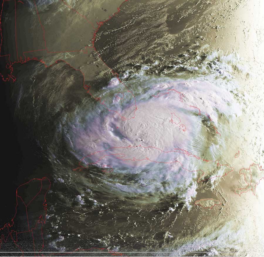
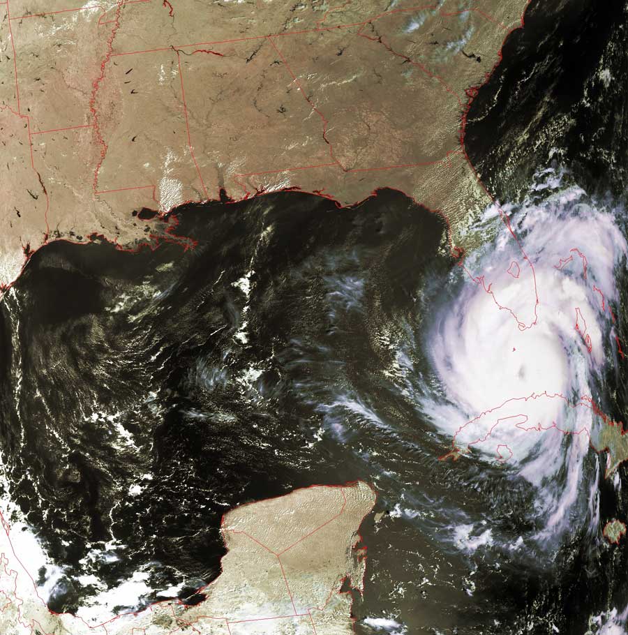
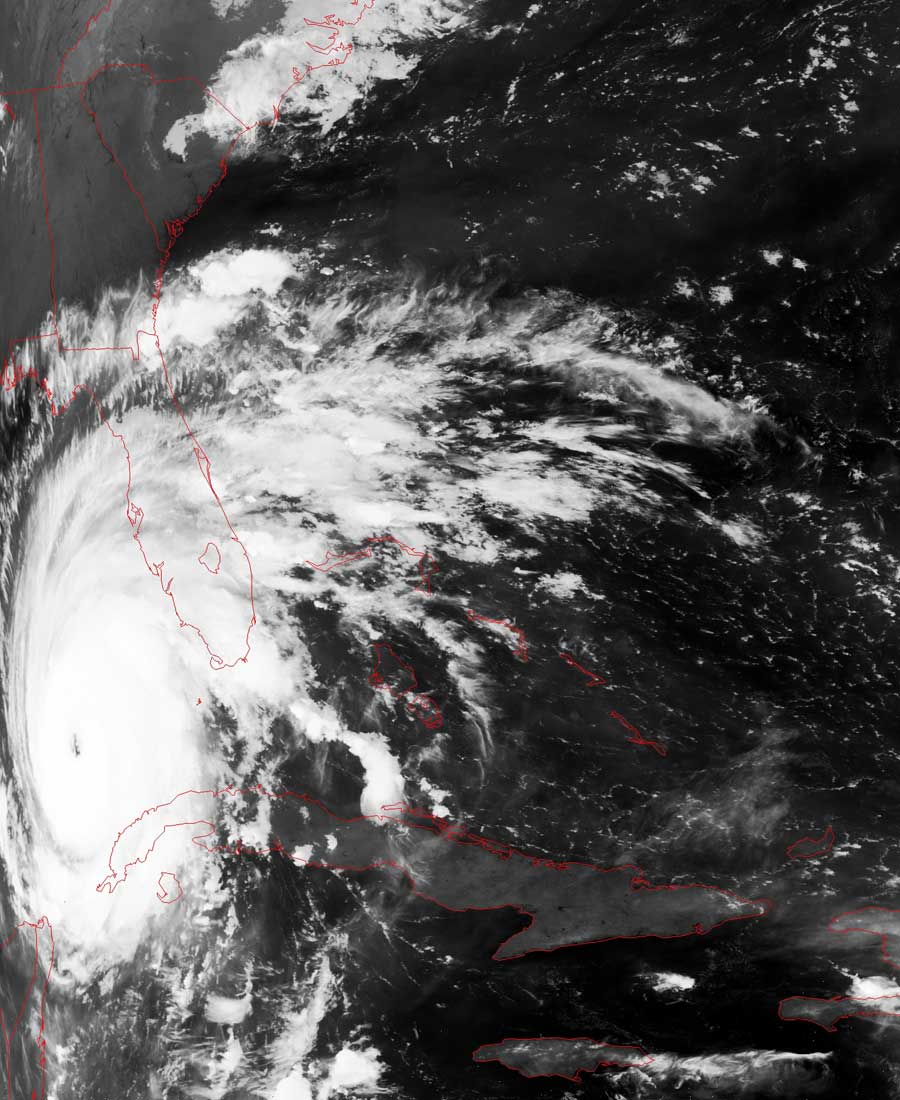
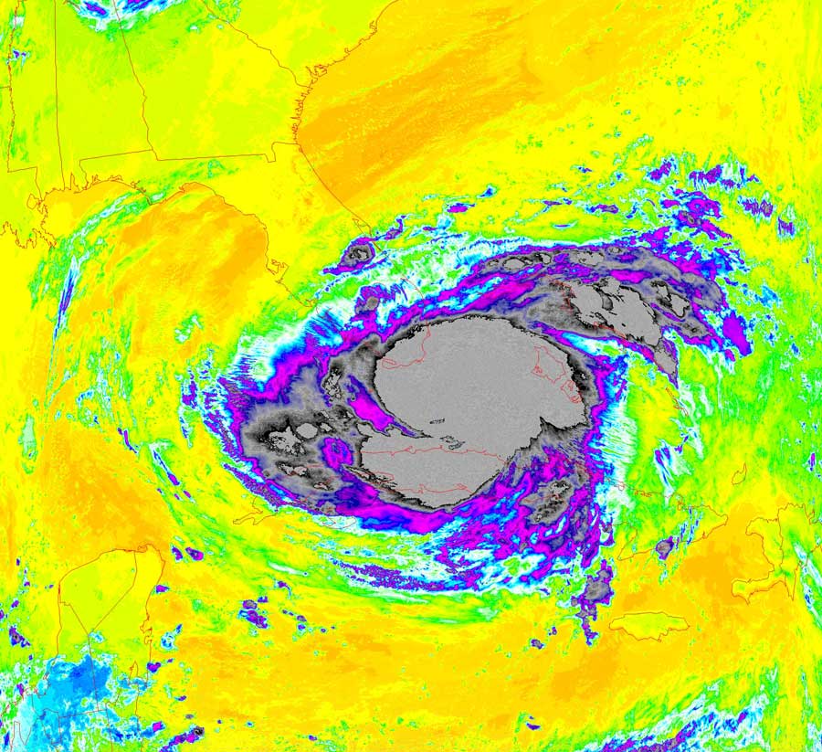
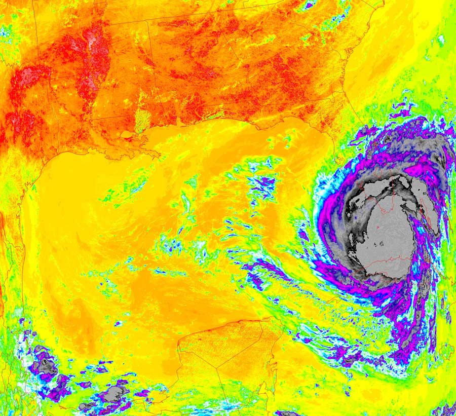
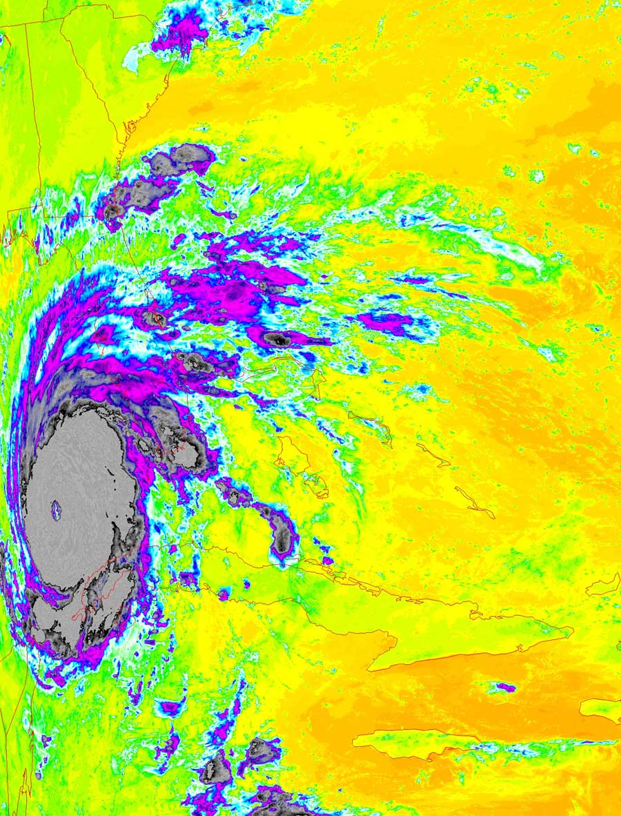
Rita: Evolution From Tropical Storm to Hurricane
The series of images below show the evolution of Rita from a
tropical storm to a hurricane.
Hurricanes draw their remarkable power from evaporation of warm waters below
them.
While Rita is dragging over both Cuba and the Florida peninsula, she can't draw
much power since there is less water available for evaporation.
However, once she starts to clear Cuba and Florida, and gets over the warm
waters of the Gulf of Mexico, she is able to spin up into a full hurricane.
From these images, you can also see that her path will take her across the Gulf,
towards the Texas coast.
The color key for the thermal images is at the bottom of the page.
For perspective, note that water freezes at 00C (320F), 200C
is the same as 680F, and that -400C is the same
temperature as -400F.
Click on the image(s) below for a higher-resolution (~100k) picture.
|
Tuesday, September 20, early morning |
Tuesday, September 20, late morning |
Wednesday, September 21, early morning |
 |
 |
 |
 |
  |
 |